For residents of Austinmer, Coledale, Woonona or even Gwynneville and Mt Kembla, the escarpment could bring bushfires almost literally to their doorstep.
Subscribe now for unlimited access.
$0/
(min cost $0)
or signup to continue reading
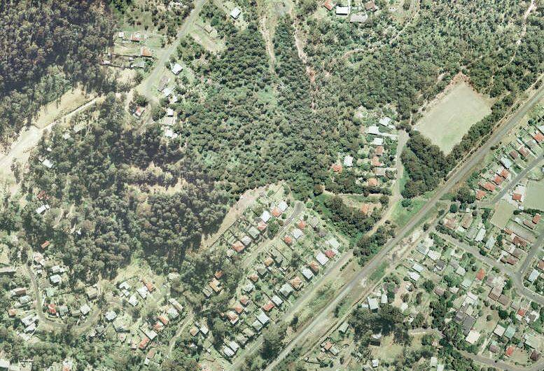
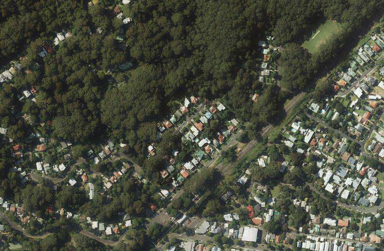
A comparison of aerial photos of these suburbs from 1977 and 2016 show a rapid increase in vegetation, as well as a larger number of houses built closer to the escarpment.
Gahans Avenue at Woonona - a hill that runs up into the edge of the escarpment - was one of the main areas hit by the 1968 bushfires.
The 1977 aerial photo show many of the houses surrounded by open land, with the trees of the escarpment sparse and still some distance away.

Speed forward to 2016 and the vegetation is thick and dense and leaning over the back fences of some homes.
The comparison is even more stark when you look at the whole of Woonona and Bulli.
In 1977 the escarpment's vegetation was more sparse, with plenty of grassland visible in between patches of forest.
But by 2016, the forest is so thick it's almost impossible to spot any grassland at all - and the aerial shot gives the impression the bush had actually overtaken some houses.
University of Wollongong researcher and fire expert Dr Owen Price said the increase in density of the escarpment's vegetation heightened the risk of bushfire - and its intensity as well.
"If you were to go from a situation in 1968 where it was paddocks and now it's forests the chances of potential impact on houses is much, much greater," Dr Price said.
"That's because of the intensity of the fire and also, it's much harder to put out.
"On one of these days like we've had where the fire's spreading quickly, you can't put it out, whereas if it's just in grass you can."
Some will see the increase in vegetation since the 1970s as a sign that more hazard reduction burns needed to occur.
But Dr Price said the rainforest was a difficult area to conduct hazard burns - usually it was too wet to burn but, when it dried out like it has now, it became simply too dangerous to burn.
That was because firefighters would not be able to control it.
Dr Price said that the solution wasn't to cut down all the trees but for those who choose to live close to the bush to understand the risk and take the necessary safety measures.
"What you have to do is concentrate more on the separation between the houses and the forest," Dr Price said.
"At the end of the day that's a personal decision. If the householders want to live in the forest that's fine, they just need to know what the risk is."


