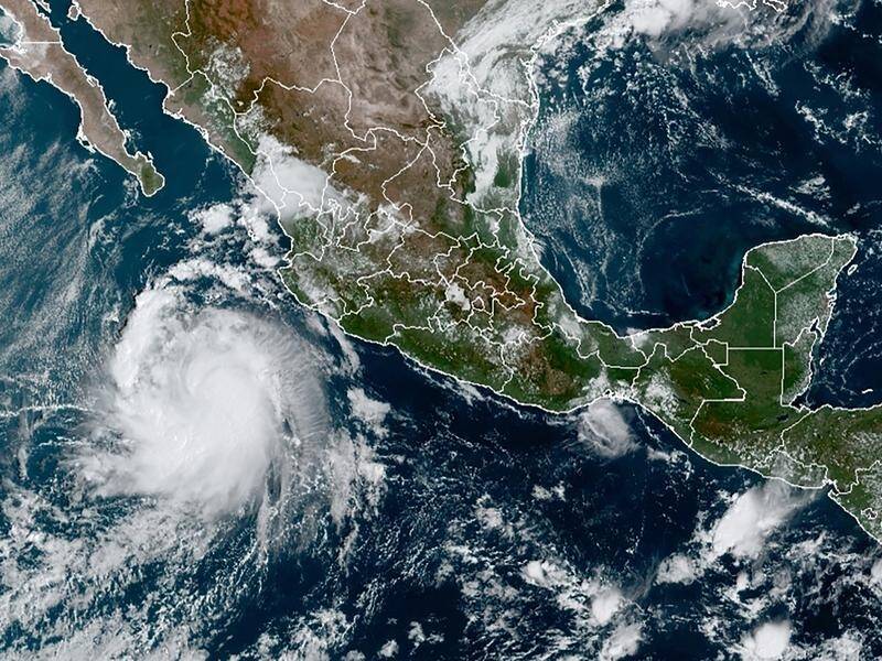
Tropical Storm Pamela has rapidly strengthened as it moves along Mexico's Pacific coast and is forecast to become a major hurricane before hitting shore somewhere near the port of Mazatlan at midweek.
Subscribe now for unlimited access.
or signup to continue reading
The US National Hurricane Center said Pamela's centre was about 700km south-southwest of Mazatlan at midafternoon Monday local time, and was moving northwest at about 11km/h).
The storm had maximum winds of about 110km/h.
Pamela was forecast to take a turn toward the north and northeast, passing south of the southern tip of the Baja California peninsula late Tuesday or early Wednesday at hurricane strength.
It is forecast to make landfall Wednesday near Mazatlan, potentially as a category-three hurricane.
Pamela was then expected to weaken while crossing over northern Mexico and could approach the Texas border as a tropical depression by Thursday.
The hurricane center warned of the possibility of life-threatening storm surge, flash floods and dangerous winds around the impact area.
Australian Associated Press

